| Local Government | Urban Greening | Strategy Implementation |
Focus
While metrics of overall urban canopy are important for understanding the total extent of the urban forest, not all of this land is under local government control. Assessing canopy cover specifically on land that councils own or manage and within local road reserve, offers a more accurate and practical foundation for urban greening efforts. Focusing on areas where local governments have both responsibility and the capacity to act enables more targeted planning, implementation, and evaluation of tree planting initiatives. This approach supports the setting of realistic goals, tracking of progress within the council’s jurisdiction, and prioritisation of planting where it is both feasible and likely to deliver the greatest impact.
The City of Gosnells also sought to visualise their tree planting initiatives and estimate the additional canopy these efforts would contribute to their urban forest over time.
Aims
As part of the implementation of its Public Tree Strategy 2022–2030, the City of Gosnells engaged the Thriving Perth Portal team to assist them with:
- Determining the level of current canopy cover in local road reserves and on land owned or managed by the City of Gosnells.
- Projecting and modelling the potential growth of canopy cover from trees planted by the City of Gosnells.
- Estimating how this growth contributes to the overall canopy cover and urban forest canopy cover targets across the city.
What we did
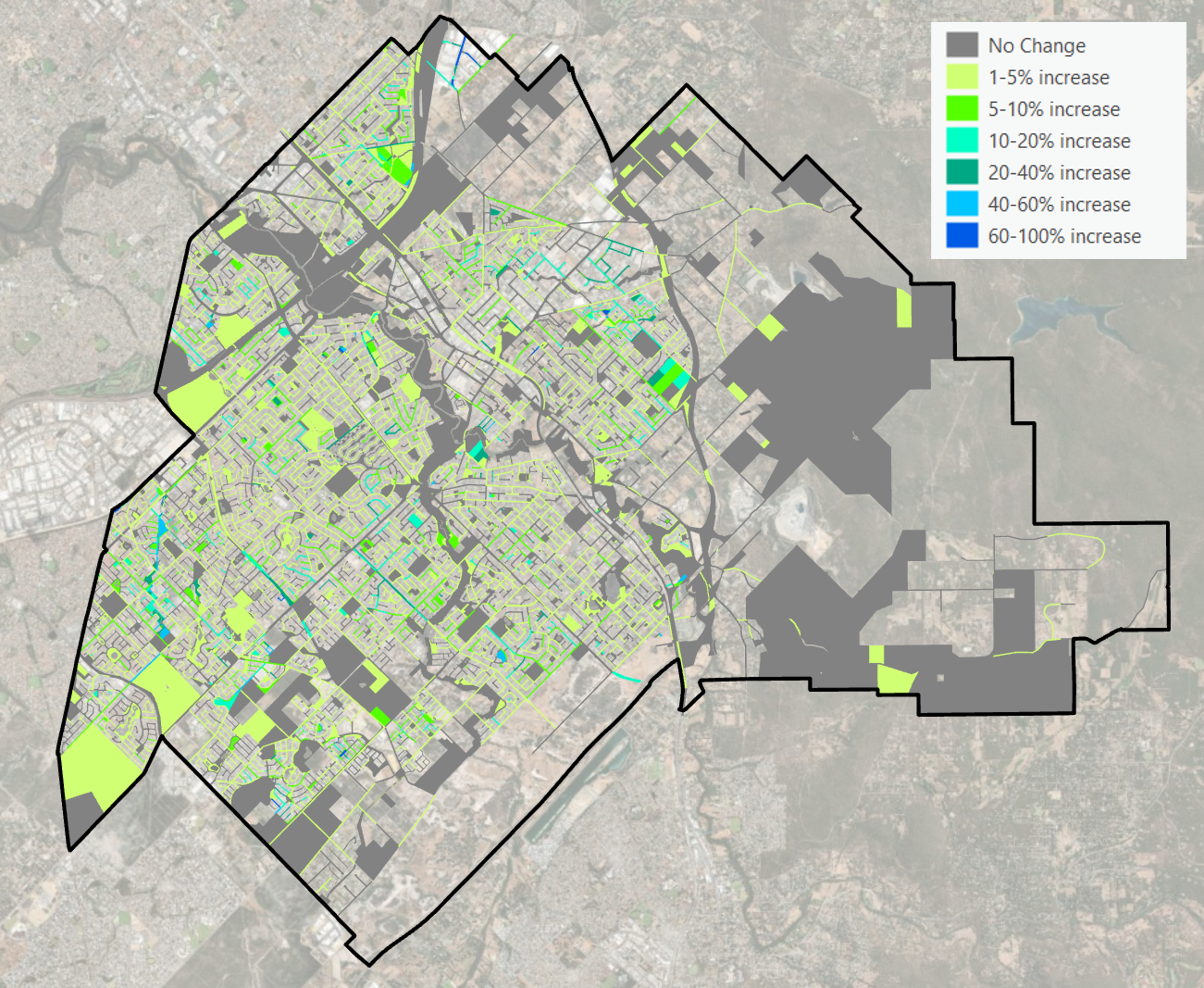
Determining the tree canopy cover on council owned and managed land
Using information provided by the City of Gosnells and the 2020 Urban Forest Parcels data layer, all local road reserves and land parcels owned or managed by the City were identified and extracted for analysis.
Many public open spaces across the City of Gosnells contain large waterbodies, which were included in the total land area (denominator) used to calculate canopy cover. Including these non-plantable areas can overstate the land available for tree planting and result in an underestimation of actual canopy cover percentages and were thus removed from the land parcels.
Canopy cover was recalculated for each individual land parcel. Total land area and canopy cover were then aggregated by land ownership type (i.e., owned, managed, and local road reserve), and the percentage canopy cover was calculated for each category.
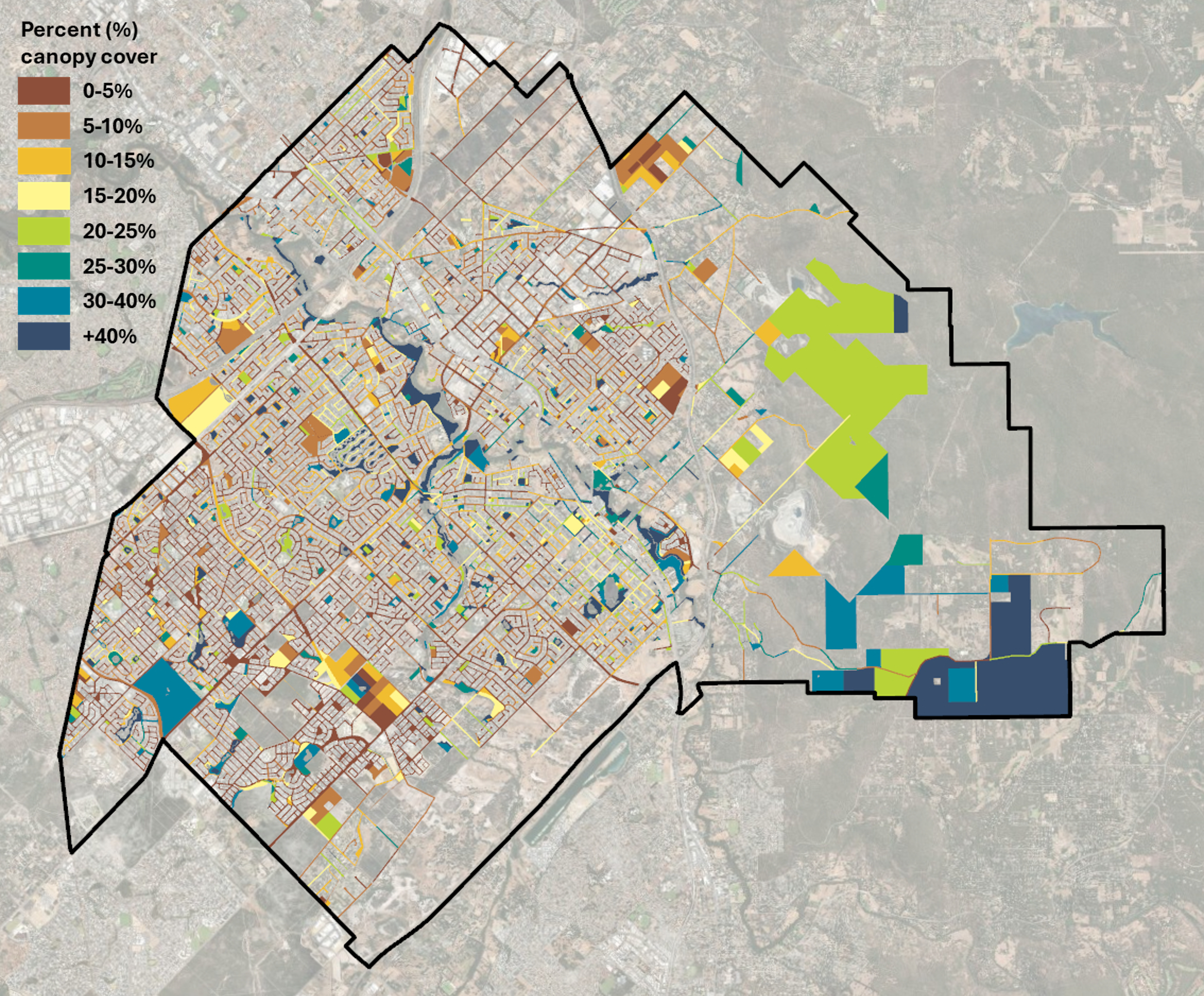
Modelling tree canopy growth
Between 2019 and 2025 the City of Gosnells planted 12,390 trees (30 litre stock / approximately three years old stock). Species-specific growth profiles were identified for all planted tree species – this included the typical maximum crown size at full maturity and the typical time (in years) to full maturity and annual growth rates calculated. Canopy growth for all trees (by species) was projected over a 20-year period, from 2019 to 2039. Each tree’s annual canopy growth was calculated from its planting year through to 2039.

The planted tree points were spatially joined to the corresponding land parcels, and annual estimates of additional canopy area resulting from tree growth were calculated. The projected total canopy cover from the 12,390 planted trees by 2039 was then computed, and the overall canopy cover percentages were updated to reflect this contribution. This analysis also assessed progress toward meeting the City’s canopy targets, providing insight into how current planting initiatives may help close the gap over time.