
Focus
The Polyphagous Shot-Hole Borer (PSHB) poses a significant threat to urban tree canopy, biodiversity, and the long-term resilience of urban forests across Perth. With the WA State Government shifting from an eradication approach to a long-term management strategy for Polyphagous Shot-Hole Borer (PSHB), early detection of PSHB and rapid response are critical to limit its spread and manage potential infestation outbreaks.
For local governments managing extensive urban forests and large tree populations, clear spatial intelligence is needed to direct limited resources toward priority monitoring, surveillance and inspections, identify the trees and locations of greatest potential risk, and guide future tree planting and species diversification strategies to reduce long-term vulnerability.
This requires local governments to have a strong understanding of their urban forest composition, together with the factors that may influence the trajectory of an infestation and the potential extent of damage caused by PSHB.
The Thriving Perth Portal team worked closely with the City of Gosnells and the City of Perth to develop the Polyphagous Shot-Hole Borer (PSHB) Risk Mapping Tool to provide a robust spatial, evidence-based approach to identifying areas of the urban forest that are most vulnerable to infestation and spread
How was the Thriving Perth Portal used?
Using tree inventory data from the local governments, trees were assessed using a multi-factor risk model that combines species susceptibility based on current DPIRD known host lists, the presence, co-location and spatial clustering of reproductive and non-reproductive host species, species diversity, localised species infestation rates, proximity to confirmed infested trees, and beetle activity derived from trap monitoring data.
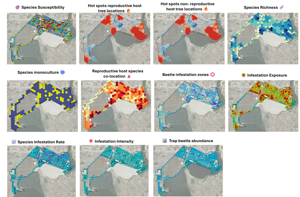
These factors were normalised and combined to generate a composite PSHB risk score for each tree which were then analysed using spatial clustering techniques to identify statistically significant hotspots of elevated PSHB risk.
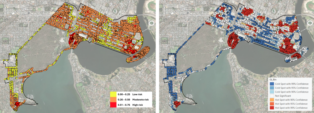
Using the PSHB Risk Mapping Tool
If your local government would like to discuss using and applying the PSHB Risk Mapping Tool please get in touch.