Walking & Cycling | Urban Greening | Pedestrian infrastructure
Focus
Improving the walkability, safety and comfort of routes to school is a critical step toward encouraging active transport in children and young adults and fostering healthier, more connected communities.
How was the Thriving Perth Portal Used?
We used data layers from the Thriving Perth Portal to develop two new indicators assessing the 800-metre walkable catchment areas surrounding all government primary (n = 365) and secondary (n = 80) schools across the Perth and Peel metropolitan region:
- The total length of roads with footpaths
- The total area of those footpaths that are shaded by tree canopy
These indicators are visualised within the Thriving Perth Portal, enabling users to assess the quality and comfort of routes to school and identify priority locations for investment in missing footpaths, safer pedestrian connections, and increased tree planting.
Roads with footpaths
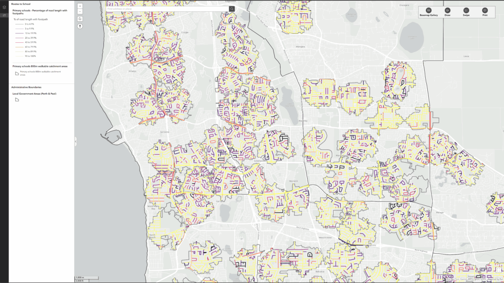
All roads within the 800-metre walkable catchment areas around each school were assessed for the presence of adjacent footpaths. For each road segment, the percentage of its length with an adjacent footpath was calculated, and the total length of roads with footpaths within each school catchment area was determined.
Tree canopy cover over footpaths
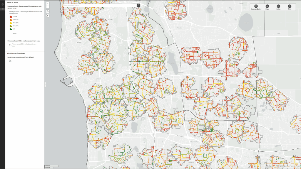
All footpaths within the 800-metre walkable catchment areas around each school were assessed for the presence of tree canopy cover providing shade. For each footpath segment, the percentage of its area with tree canopy cover was calculated, and the total area of footpaths with canopy cover within each school catchment area was determined.
Public health benefits and strategic alignment
This is particularly important for Public Health Plans because safe, connected and shaded walking routes help remove barriers to walking and cycling to school, support daily physical activity, improve child independence, reduce traffic congestion around schools, and lessen exposure to heat during hotter months. Improving routes to school can also contribute to mental wellbeing, social connection and healthier travel behaviours across the community.
The measure also strongly aligns with broader local government strategies and operational priorities, including active transport plans, road safety strategies, urban forest and greening strategies, climate adaptation and heat mitigation plans, liveability and place-making objectives, and sustainability goals. As such, it provides a practical cross-sector indicator that can help councils integrate Public Health Plan actions with existing infrastructure and environmental investment programs.
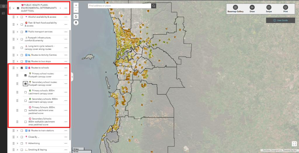
Find and explore the routes to school data in the ‘Environmental Determinants Audit Tool’ section on the portal.