
The ability to physically reach healthcare services is a critical component of healthcare delivery and an important determinant of health equity and health outcomes.
Reliable information on the location and distribution of health services provides an important evidence base for understanding equitable access, informing service planning, and supporting resilient communities. Understanding where services are located, how they are distributed across the region, and how easily different communities can access different types of care can help identify gaps in service provision, communities with poorer access, and areas where additional or future health services may be needed.
The National Health Services Directory (NHSD) is a comprehensive national directory of health services and practitioners, funded by Australian governments and managed by Healthdirect Australia. It provides consistent, authoritative, up-to-date and accessible information about health services.
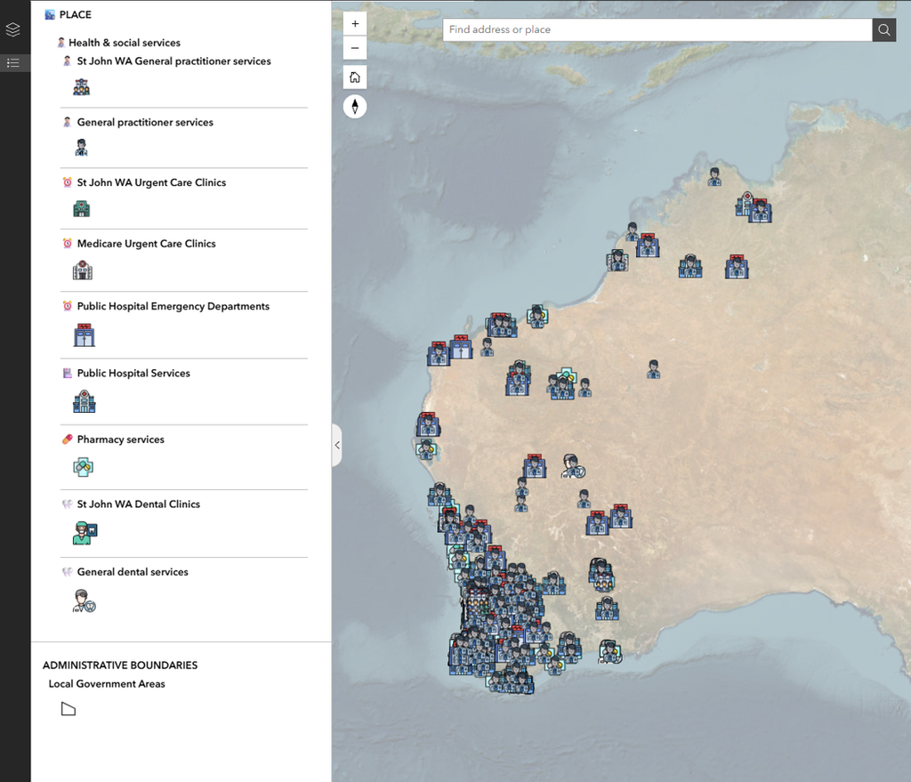
Using data from the National Health Services Directory (NHSD), we have created a five spatial layers showing the location and distribution of key health services across Western Australia:
– General practitioner (GP) services
– Dental services
– Urgent and emergency care services
– Public hospital services
– Pharmacy services
What can you do with the data?
These new health service layers can be viewed and analysed alongside the wide range of demographic, socioeconomic, population, transport, environmental and community infrastructure data available within the Thriving Perth Portal.
Examples of how the data might be used include:
(1) Map the distribution of health services and identify areas with higher or lower levels of service provision.
(2) Explore geographic access to health services, including which communities have different types of healthcare available close to where they live.
(3) Identify potential gaps in service provision, particularly in areas experiencing population growth or higher levels of health and social need.
(4) Assess accessibility by different modes of transport, including walking, cycling, public transport and driving.
(5) Compare access across communities and local government areas to identify spatial inequalities in health service provision.
(6) Plan for population and demographic change by examining whether the location and capacity of existing services align with population growth, ageing populations, changing demographics and emerging growth corridors.
(7) Explore health service resilience in a changing climate and support emergency response planning by considering the location and accessibility of health services alongside environmental hazards such as extreme heat, bushfire and flooding, helping identify communities and services that may be vulnerable during emergencies and inform preparedness, response and recovery planning.
(8) Support place-based health service planning by bringing together information about health services, population need and the built and natural environment to identify areas where additional or future services may be required.
St John WA health service data
We have also extracted and mapped publicly available St John WA health service location data to create additional spatial layers showing the locations of:
– St John Urgent Care clinics
– St John General Practice (GP) services
– St John Dental services
These layers complement the National Health Services Directory (NHSD) data and provide additional information on the location and distribution of primary, urgent and dental healthcare services across Perth and Peel.
Coming soon! Measuring access to health services through the Close By… analysis
The Thriving Perth Portal’s Close By analysis examines how accessible different types of health services are to communities across Perth and Peel. Different accessibility measures are applied according to the role of each service, the geographic catchment it serves, and how people are likely to access it:
GP services and pharmacies – within 1 km
Provides an indication of access to everyday healthcare services available within the local community and potentially accessible by walking or a short local trip.
Urgent and Emergency Care services – within a 15-minute drive
Reflects the larger catchments served by these facilities and the importance of timely access when urgent or emergency care is required.
Public hospitals – within a 30-minute drive
Recognises that hospitals provide higher-order services to much larger geographic catchments and are not expected to be located within walking distance of every community.