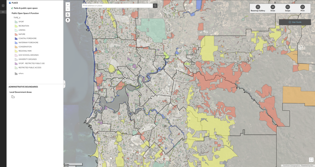
We are pleased to announce the release of a new Public Open Space (POS) Layer within the Thriving Perth Portal, providing a comprehensive spatial map of parks and public open spaces across metropolitan Perth and 11 major regional centres in Western Australia.
The layer integrates regionally significant POS identified in regional planning schemes together with local parks, reserves and recreation spaces captured from local government planning schemes. It also includes government primary and secondary school grounds as important community open space assets.
Each site has been classified according to its primary function to help users better understand the role, diversity and distribution of open space across communities. These function classifications were informed by a national review of 165 local government public open space strategies to help harmonise the terminology and classification systems used across jurisdictions, including:
- Sport
- Recreation
- Linking spaces
- Nature reserves
- Conservation areas
- Regional parks
- Coastal foreshore reserves
- Waterway foreshore reserves
- School grounds
- University grounds
Each site has been also classified according to its size based on it area in hectares:
- Small: ≤0.4 ha
- Local: >0.4 to ≤1 ha
- Neighbourhood: >1 to <5 ha
- District: ≥5 ha
The dataset includes information on the presence of key assets and facilities such as playgrounds, active recreation infrastructure (including skate parks, BMX tracks, bike tracks, outdoor gym equipment and basketball half courts), as well as amenities such as drinking fountains and public toilets.
In addition, the layer identifies sites with a water management function or recognised drainage purpose, including those containing open drainage channels, sumps, compensating basins, stormwater basins, or land designated for drainage and water management purposes.
This new dataset provides an important evidence base for planning, liveability, recreation access, health promotion and open space investment decisions.
Find the public open space data layer in the 🏙️ PLACE theme, under the 🍃 Parks and Public Open Space section.